 |
Almond
is a peaceful, secluded village located on the banks of the Nantahala River in Graham County, North Carolina. Graham County is 80% national forest land, with The Nantahala National Forest spreading out over 527 thousand acres. Lush green forest, mountains with cascading waterfalls and numerous creeks and rivers make up this beautiful, natural region. Nearly 600 miles of roads and trails wind through the Nantahala Forest, including parts of the Appalachian Trail and the Bartram Trail, making it a hiker's paradise. Just a few of the other recreational activities available near the town of Almond include swimming in mountain lakes, fishing in crystal clear streams, hunting, mountain biking, horseback riding, rock climbing, whitewater rafting on the Nantahala Gorge and golfing amid gorgeous mountain views. Nearby are the towns of Banner Elk and Boone, which have four ski resorts for exciting wintertime fun. Almond is conveniently located near the Great Smoky Mountains National Park, Blue Ridge Parkway, Cherokee Indian Reservation & Casino, craft shops, flea markets, country auctions and more. All that you need for a relaxing, fun-filled mountain vacation can be found in or around Almond, North Carolina.
Surrounding areas: Alarka, North Carolina (6.8 mi), Stecoah, North Carolina (7.1 mi), Bryson City, North Carolina (7.9 mi), Nantahala, North Carolina (8.0 mi), Topton, North Carolina (11.5 mi), Aquone, North Carolina (11.8 mi), Whittier, North Carolina (12.4 mi)
|

|
Almond Vacation Rentals
|

|
|
|
|
|
Almond Hotels and Resorts
|
|
|
| | | Hotels & Motels |
| Charleston Inn | 208 Arlington Ave | Bryson City, NC | 7.5 mi. | (828) 488-4644 | | Nantahala Village Mountain Resort | 9400 Hwy 19 West | Bryson City, NC | 7.9 mi. | (828) 488-2826 | | Sleep Inn | 500 SPG St | Bryson City, NC | 7.9 mi. | (828) 488-0326 | | Ela Motor Court | 5280 Ela Rd | Bryson City, NC | 11.6 mi. | (828) 488-2284 | | Lloyd's On The River | 5370 Ela Rd | Bryson City, NC | 11.7 mi. | (828) 488-3767 | | Microtel Inn & Suites Robbinsville | 107 Rodney Orr By-Pass | Robbinsville, NC | 14.0 mi. | (828) 479-6772 | | San-ran Motel | | Robbinsville, NC | 14.0 mi. | (828) 479-3256 | | Comfort Suites | 35 Hwy 441 North | Cherokee, NC | 15.8 mi. | (828) 497-3500 | | Days Inn Smokey Mountain Inn | 660 Painttown Rd | Cherokee, NC | 15.8 mi. | (828) 497-2300 | | Econo Lodge | Us Hwy 19 | Cherokee, NC | 15.8 mi. | (828) 497-4575 | | Fairfield Inn & Suite - Cherokee | 568 Painttown Rd | Cherokee, NC | 15.8 mi. | (828) 497-0400 | | Hampton Inn | 185 Tsalagi Rd | Cherokee, NC | 15.8 mi. | (828) 497-3115 | | Holiday Inn Cherokee | Hwy 19 W | Cherokee, NC | 15.8 mi. | (828) 497-9181 | | Holiday Inn Expres Hotel & Suites | 376 Paint Town Rd | Cherokee, NC | 15.8 mi. | (828) 497-3113 | | Holiday Inn | Hwy 19 S | Cherokee, NC | 15.8 mi. | (828) 497-9181 | | Microtel Inn & Suites | 674 Casino Trl | Cherokee, NC | 15.8 mi. | (828) 497-7800 | | Quality Inn-cherokee | US 441 N Byp | Cherokee, NC | 15.8 mi. | (828) 497-4702 | | Ramada Limited | 196 Painttown Rd | Cherokee, NC | 15.8 mi. | (828) 497-4231 | | Sleep Inn | Hwy 441 Pob 1956 | Cherokee, NC | 15.8 mi. | (828) 497-4730 | | Travelodge | Acquoni Rd | Cherokee, NC | 15.8 mi. | (828) 497-2226 | | Snow Hill Inn | 531 Snow HL Rd | Franklin, NC | 16.6 mi. | (828) 369-2100 | | Days Inn | 1320 E Main St | Franklin, NC | 16.7 mi. | (828) 524-6491 | | Baymont Inn-Cherokee/Smoky MTNS | 1455 Acquoni Rd | Cherokee, NC | 16.8 mi. | (828) 497-2102 | | Best Western Great Smokies Inn | 1636 Acquoni Rd | Cherokee, NC | 16.8 mi. | (828) 497-2020 | | Hampton Inn | 244 Cunningham Rd | Franklin, NC | 17.4 mi. | (828) 369-0600 | | Microtel Inn & Suites | 81 Allman Dr | Franklin, NC | 17.4 mi. | (828) 349-9000 | | Best Western River Escape Inn And Suites | 248 Wbi Dr | Dillsboro, NC | 17.6 mi. | (828) 586-6060 | | Mountain Creek Cottages | 162 Dicks CRK Rd | Dillsboro, NC | 17.6 mi. | (704) 586-6042 | | Andrews Valley Inn | Beavercreek Rd | Andrews, NC | 18.7 mi. | (888) 777-7901 | | Comfort Inn | Hwy 23/74 | Sylva, NC | 19.1 mi. | (828) 586-3315 | | University Inn | 563 N Country CLB Dr | Cullowhee, NC | 22.3 mi. | (828) 293-5442 | | Shoney's Inn & Suites | 515 Airport Rd | Gatlinburg, TN | 23.3 mi. | (865) 436-5883 | | Gazebo Inn | 417 Airport Rd | Gatlinburg, TN | 23.4 mi. | (865) 436-2222 | | Jack Huff's Motor Lodge | 204 Cherokee Orchard Rd | Gatlinburg, TN | 23.4 mi. | (865) 436-5171 | | Park Vista Resort Hotel | 705 Cherokee Orchard Rd | Gatlinburg, TN | 23.4 mi. | (865) 436-9211 | | Quality Inn Creekside | 125 Leconte Creek Dr | Gatlinburg, TN | 23.5 mi. | (865) 436-4865 | | Microtel | 211 Airport Rd | Gatlinburg, TN | 23.6 mi. | (865) 436-0107 | | Comfort Inn Parkside | 7824 E Lamar Alexander Pkwy | Townsend, TN | 23.6 mi. | (865) 448-9000 | | Hampton Inn | 7829 E Lamar Alexander Pkwy | Townsend, TN | 23.6 mi. | (865) 448-9000 | | Econo Lodge Inn & Suites | 135 Reagan Dr | Gatlinburg, TN | 23.7 mi. | (865) 436-7991 |
| | | Bed & Breakfast |
| Freeze House Bed And Breakfast | 71 Sylvan Heights | Sylva, NC | 19.1 mi. | (828) 586-8161 |

|
Almond Weather & Climate
|

|
|
|
The Mountains of North Carolina range from 800 feet to over 6,600 feet and topography affects the local weather. Expect temperatures to be 10 to 20 degrees cooler on the mountaintops. Spring is unpredictable, particularly at the higher elevations. Snow may fall in March, but by May, things warm up with daytime highs in the 80s. Summer is warm and humid, but more pleasant at the higher elevations. Afternoon showers and thunderstorms are common in the summertime. Winter is generally moderate, but extreme conditions can occur in the mountains. It's not unusual to have warm temperatures in the valleys and snow in the higher areas. In the lowlands, snows of one inch or more occur just 1-5 times per year. More frequent and deeper snows fall at the higher elevations.
|
| Month |
High Temp |
Low Temp |
Rainfall |
Ocean Temp |
| January |
47°F |
24°F |
5.39 in. |
- |
| February |
52°F |
25°F |
4.89 in. |
- |
| March |
60°F |
32°F |
5.76 in. |
- |
| April |
68°F |
38°F |
4.09 in. |
- |
| May |
75°F |
49°F |
4.90 in. |
- |
| June |
81°F |
57°F |
4.49 in. |
- |
| July |
84°F |
61°F |
4.09 in. |
- |
| August |
83°F |
61°F |
4.48 in. |
- |
| September |
77°F |
55°F |
3.94 in. |
- |
| October |
69°F |
41°F |
3.29 in. |
- |
| November |
59°F |
32°F |
4.58 in. |
- |
| December |
50°F |
26°F |
4.57 in. |
- |

|
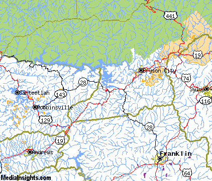
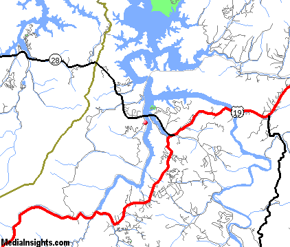
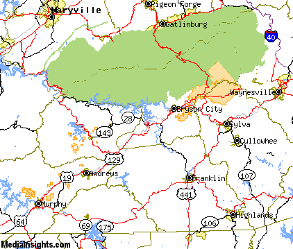
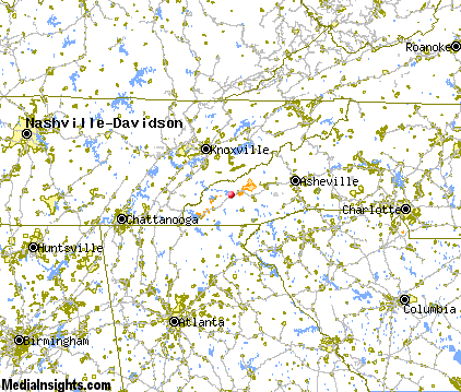
Almond Map & Transportation
|

|
|
 |
|
|
| Click each thumbnail image to enlarge. |
 |
|
 |
 |
The closest airports in the area are the Gatlinburg Pigeon Forge airport (GKT) located about 33 miles north of Almond in Sevierville, Tennessee, the Mc Ghee Tyson airport (TYS) located approximately 38 miles northwest of Almond in Knoxville, Tennessee, the Moore Murrell airport (MOR) located roughly 56 miles north of Almond in Morristown, Tennessee, the Asheville Regional airport (AVL) located around 57 miles east of Almond in Asheville, North Carolina, and finally the Greeneville Greene County Municipal airport (GCY) located about 70 miles northeast of Almond in Greeneville, Tennessee.
|

|
Almond Attractions
|

|
|
| | | Amusement and Theme Parks |
| Cherokee Fun Park | Cherokee | NC | 15.8 mi. | | | Santa's Land | Cherokee | NC | 15.8 mi. | | | Ghost Town in the Sky | Maggie Valley | NC | 28.2 mi. | | | Dollywood | Pigeon Forge | TN | 28.9 mi. | | | Rockin' Raceway | Pigeon Forge | TN | 28.9 mi. | | | NASCAR SpeedPark | Sevierville | TN | 34.4 mi. | |
| | | Water Parks |
| Lake Lanier Island Beach & Water Park | Lake Lanier Island | GA | 86.5 mi. | | | White Water Park | Marietta | GA | 112.8 mi. | |
| | | Golf Courses |
| Smoky Mountain Country Club | Whittier | NC | 12.3 mi. | | | Franklin Golf Course | Franklin | NC | 16.6 mi. | | | Mill Creek Country Club | Franklin | NC | 16.6 mi. | | | Laurel Valley Country Club | Townsend | TN | 23.7 mi. | | | Chatuge Shores Golf Course | Hayesville | NC | 26.5 mi. | | | Mountain Harbour Golf & Yacht Club | Hayesville | NC | 26.5 mi. | | | Gatlinburg Municipal Golf Course | Pigeon Forge | TN | 29.3 mi. | | | Highlands Cove | Highlands | NC | 29.9 mi. | |
| | | Ski Areas |
| Cataloochee | Maggie Valley | NC | 28.2 mi. | | | Scaly Mountain | Scaly Mountain | NC | 28.4 mi. | | | Ski Wolf Laurel | Mars Hill | NC | 65.2 mi. | | | Ski Beech | Banner Elk | NC | 109.6 mi. | | | Sugar Mountain Ski Area | Banner Elk | NC | 109.6 mi. | | | Hawksnest Golf & Ski Resort | Seven Devils | NC | 111.2 mi. | |
| | | State Parks |
| Chatuge State Park | | GA | 31.5 mi. | | | Black Rock Mountain State Park | | GA | 33.6 mi. | | | Moccasin Creek State Park | | GA | 36.6 mi. | |
| | | Museums |
| Sequoyah Birthplace Museum | Vonore | TN | 41.0 mi. | (History) | | East Tennessee Discovery Center | Knoxville | TN | 45.5 mi. | (Science) | | Ewing Gallery of Art & Architecture | Knoxville | TN | 45.5 mi. | (Art) | | Knoxville Museum of Art | Knoxville | TN | 45.5 mi. | (Art) | | East Tennessee Historical Society Museum | Knoxville | TN | 45.5 mi. | (History) | | Farragut Folklife Museum | Farragut | TN | 48.5 mi. | (History) | | South Carolina Gold Museum | Pickens | SC | 59.0 mi. | (Miscellaneous) | | American Museum of Science and Energy | Oak Ridge | TN | 59.4 mi. | (Science) |
| | | Zoos and Aquariums |
| Knoxville Zoological Gardens | Knoxville | TN | 45.5 mi. | | | Western North Carolina Nature Center | Asheville | NC | 59.1 mi. | | | Greenville Zoo | Greenville | SC | 75.2 mi. | | | Tennessee Aquarium | Chattanooga | TN | 101.0 mi. | | | Warner Park Zoo | Chattanooga | TN | 101.0 mi. | |
Notice a problem with the information on this page? Please notify us.
|
Disclaimer: We recommend you conduct your own research regarding all accomodations and attractions found on this website. The distances shown on this website are straight-line distances as the crow flies. The road distance may be considerably longer. You assume all liability for use of any information found on this website. No information is confirmed or warranted in any way. By using our services you agree to the terms and conditions of this disclaimer.
|
| We are the #1 site for your North Carolina Vacation presenting North Carolina vacation rentals, hotels, weather and map for each city. |
North Carolina Vacation .com
©1997-2025 All Rights Reserved.
|
|